Risk Finder: California
See More States
Choose a tool:
Searchable interactive map of sea level rise & flood risk areas
CLICK TO EXPLORE: San Diego, San Francisco, Sacramento, Los Angeles, Long Beach, Oakland, San Jose, San Mateo County, Marin County, 94901, Orange County, California, plus many more places & place types via the tool.

Sea level rise & flood risk projections
CLICK TO FORECAST: San Diego, San Francisco, Sacramento, Los Angeles, Long Beach, Oakland, San Jose, San Mateo County, Marin County, 94901, Orange County, plus many more places & place types via the tool.

Comprehensive analysis of sea level rise & flood exposure, by place
CLICK TO REVIEW: California, San Diego, San Francisco, Sacramento, Los Angeles, Long Beach, Oakland, San Jose, San Mateo County, Marin County, 94901, Orange County, plus many more places & place types via the tool.
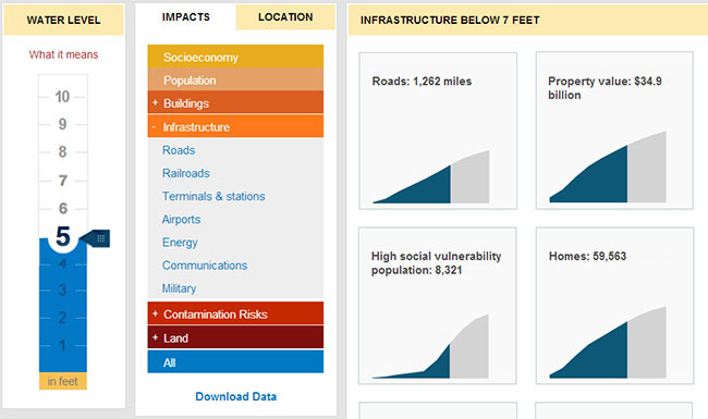
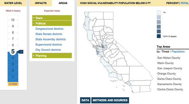
Heat maps of sea level rise & flood exposure, by topic
CLICK TO COMPARE: Population, Property, Homes, Roads, EPA sites, Schools, Land, Railroads, Power Plants, High Social Vulnerability Population, plus many more feature types, via the tool.
Brief one-stop reports integrating analysis from across the tool
CLICK TO READ: San Diego, San Francisco, Sacramento, Los Angeles, Long Beach, Oakland, San Jose, San Mateo County, Marin County, 94901, Orange County, plus many more places & place types via the tool.