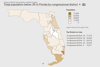
People, property, infrastructure, contamination risks and more Coastal analysis available for the continental US:
Search for your location >>
One-page fact sheets with maps, local findings, and resource lists Slideshow-ready graphs & tables that can be plugged into reports or presentations Detailed spreadsheets full of our research results
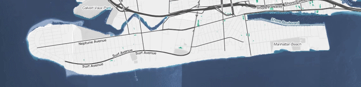
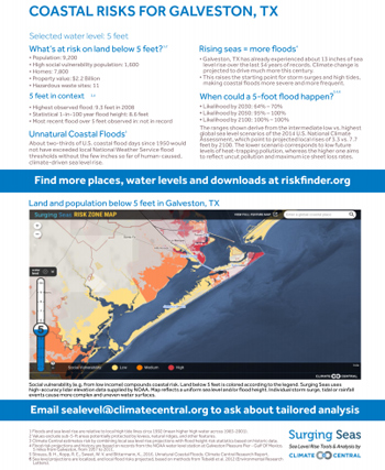
Set your location and water level to get started >>
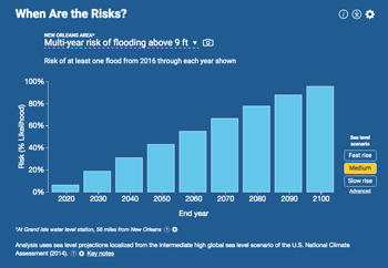
See the effect sea level rise has on mild, moderate and extreme floods Understand how both single-year and cumulative risks increase over time Choose among different underlying climate models to fully consider your risk
Have more specific needs? Learn about our custom work. Contact us by replying to this email, or at sealevel@climatecentral.org
Contact Us