News
‘Risk Zone’ Map Redesigned and Expanded Globally
Published 11/8/15
November 8, 2015 By Climate Central Climate Central has launched a redesigned version of its Surging Seas Risk Zone Map, and extended the map from U.S.-only to global coverage. Our goal is to provide a powerful new web tool to boost global understanding and communication of sea level rise and coastal flooding under different carbon emissions scenarios, and to better inform coastal planning and resilience efforts globally. New Risk Zone Map features include: Ability to explore inundation risk up to 30 meters (100 feet) high across the world's coastlines Local sea level rise projections at over 1,000 tide gauges on 6 continents… More »
New Report and Maps: Rising Seas Threaten Land Home to Half a Billion
Published 11/2/15
November 8, 2015 By Climate Central Carbon emissions causing 4°C of warming — what business-as-usual points toward today —- could lock in enough sea level rise to submerge land currently home to 470 to 760 million people, with unstoppable rise unfolding over centuries. At the same time, aggressive carbon cuts limiting warming to 2°C could bring the number as low as 130 million people. These are the stakes for global climate talks December in Paris. Our analysis details the implications of different warming scenarios for every coastal nation and megacity on the planet, and our globally searchable… More »
‘Mapping Choices’ Launched to Visualize Carbon Choices
Published 10/12/15
In conjunction with new peer-reviewed scientific research led by Climate Central in collaboration with Anders Levermann of the Potsdam Institute of Climate Impact Research, and published Monday in the Proceedings of the National Academy of Sciences, Climate Central has launched Mapping Choices, an interactive online map that allows anyone to visually compare the long-term consequences that different carbon choices could lock in. Our goal is to offer a new way to essentially see the future, for every coastal city and ZIP code in the US, and better understand what different emissions or warming levels ultimately mean. The sea level… More »
Commitment to Release Surging Seas for All Coastal States
Published 3/19/14
Surging Seas 2.0 March 19, 2014 Concurrent with today’s launch of the federal Climate Data Initiative, Climate Central is proud to publish its own commitment to launching the next generation of its Surging Seas web tool and analysis for every coastal state in the U.S. Update: the tool has been launched so far for Alabama, California, Delaware, Connecticut, Florida, Georgia, Louisiana, Maine, Maryland, Massachusetts, Mississippi, New Hampshire, New York, New Jersey, North Carolina, Oregon, Rhode Island, South Carolina, Texas, Virginia, Washington and Washington, D.C. Surging… More »
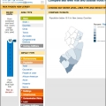
Major Expansion of Surging Seas Launched
Published 10/23/13
October 23, 2013 We're proud to announce the launch of our interactive data toolkit, the Surging Seas Risk Finder. It incorporates the latest, high-resolution, high-accuracy lidar elevation data supplied by NOAA and assesses exposure of over 100 infrastructure and other elements — from airports to road miles, from schools to hospitals to wastewater treatment plants — in order to allow users to explore vulnerability from zip code through city, county and state levels. It provides the ability to compare risk across areas, as well as the ability to analyze the likelihood of coastal flood and sea level threats occurring in… More »